Maps auctions
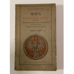
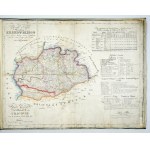
Collector's Map of the Republic of Poland " Poland in the year 1771 - with the addition of orientation cards of the three divisions of the Duchy of Warsaw and the district of the Free City of Cracow " Fourth Edition . AUTHOR Jan Babirecki , Spółka Wydawnicza " Polska " w Krakowie , Drukarnia "Czasu" w Krakowie .Map format - 58,5 x 64 cm. Map on canvas with original publisher's cover, with Po...
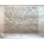
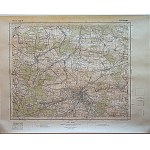
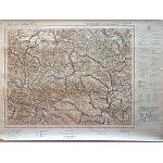
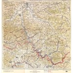
KRZEPICE. Lane 45, Pole 27, W-wa 1933. published by WIG. Scale 1 : 100,000. format 47/35 cm. Colored.
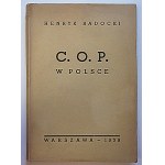
RADOCKI HENRYK. The Central Industrial District in Poland. Genesis - Territory - Population - Farming - Cities - C.O.P. As an investment area - Importance and tasks of C.O.P. Orientation maps. Tables. W-wa 1939. Nakładem "Mysli Polskiej". Druk. W. Lazarski. Dzierż. Spółdzielnia "SPÓJNIA", Format 15/22 cm. p. 147. opr., broch., ed. (J).
CZĘSTOCHOWA. Pas45. Pole 28. w-wa 1933. published by WIG. Scale 1 : 100,000. format 46/35 cm. Colored.
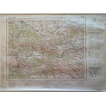
OLKUSZ. Lane 47. pole 29. w-wa 1933. published by WIG. Scale 1 : 100,000. format 48/36 cm. Colorful
14 EUR
OLKUSZ. Lane 47. pole 29. w-wa 1933. published by WIG. Scale 1 : 100,000. format 48/36 cm. Colored.
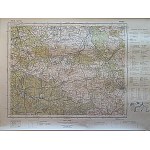
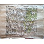
WOŹNIKI. lane 46. pole 28. w-wa 1934. published by WIG. Scale 1 : 100,000. format 46/35 cm. Colored
14 EUR
WOŹNIKI. lane 46. pole 28. w-wa 1934. published by WIG. Scale 1 : 100,000. format 46/35 cm. Colored.
[POLAND - atlas]. KOLBERG Juliusz - Atlas of the Kingdom of Poland. Atlas du Royaume de Pologne. [Warsaw 1826-827; School Lithographic Institute]. folio, maps 8. bound in period psk. (repaired) with preserved pamphlet cover. CKZK 5, 82. Repaired binding: new spine with pasted-on fragments of old leather, new corners, new lining, rubbing of covers. Duplicated maps, three maps with small losses,...
SKOCZÓW. Lane 49. pole 27. w-wa 1934. published by WIG. Scale 1 : 100,000. format 47/ 35 cm. Colored.
LUBLINIEC. Lane 46. pole 27. w-wa 1933. published by WIG. Scale 1 : 100,000. format 46/35 cm. Colored.
[TATRY]. The High Tatras according to photographs of 1896/97. color lithograph form. 74,3x111,...
84 EUR
[TATRY]. The High Tatras according to photographs from 1896/97. Color lithograph form. 74.3x111.5 cm. Map published by Tatra Society in Cracow in 1903, printed in c. and k. Military Geographical Institute in Vienna. The nomenclature was established by W. E. Radzikowski, W. Kulczynski and S. E. Radzikowski (data under the lower frame on the right). Title in the center above the lower frame, sca...
DZIAŁOSZYN. Lane 44. pole 28. w-wa 1934. published by WIG. Scale 1 : 100,000. format 47/ 35 cm. Colored.
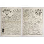
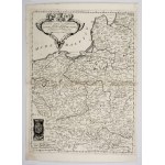
[POLAND]. Polonia Parte Occidentale [and] Polonia Parte Orientale, Descritta, e Dedicata Dal P. Maestro Coronelli Cosmografo [...] All Illustrissimo [...] K. Fedrico Cornaro. Two copperplate engravings form. 60x45.1 on ark. 65.7x47.4 cm each. Imago Pol. K25/1. Two-section map of Poland taken from the 2-volume atlas "Corso Geografico Universale [...] del Vincenzo Coronelli" published in Venice ...
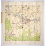
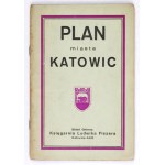
[KATOWICE]. Plan of the city of Greater Katowice and its environs. Color plan form. 54.2x53.8 cm. Plan with index published in Lodz by Księg. L. Fiszer around 1935. Plan was offset printed in Zakł. Graf. K. Miarki in Mikolow. Title in frame in upper left corner, legend there, scale (1:14,000) and city coat of arms. Under the bottom frame, details of the printing house and preparation of the ...
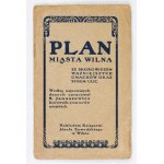
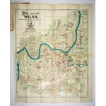
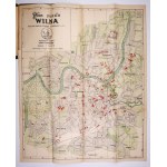
[VILNA]. Plan of the city of Vilnius. Color plan form. 56.6x46.8 cm. First edition of the plan elaborated. by St. Januszewicz, published in Vilnius in 1921 by Ksiazg. J. Zawadzki. Printed in Bydgoszcz in Zakł. Graf. "Bibliot. Pol." Plan with index. Title in frame in upper left corner, scale (1:12,500) and linear scales there. Plan divided into sectors (1-10, A-K). Verso clean. Index: "Index o...
BLAZOWA. Lane 49. pole 34. w-wa 1938. published by WIG. Scale 1 : 100,000. colored. German publisher's printed inscriptions : Grosblatt 391 so. Sonderausgabe! Nur für den Dienstgebrauch!
[SILESIA]. Superioris et Inferioris Ducatus Silesiae in suos XVII minores principatus et dominia divisi nova tabula in lucem edita. Colored copperplate form. 48.4x57.7 cm. Map of Lower and Upper Silesia published in Nuremberg by the outhouse of Johann Baptist Homann before 1729. Title cartouche (without the privilege Homann received in 1729) in the lower left corner, in the upper right corner ...
[ZAKOPANE]. Zakopane. Color plan form. 35.3x47.2 cm. Plan of Zakopane with panorama of the Tatra Mountains, published in 1940 by Gebethner and Wolff, printed at Z.W.K. Krakau works. Title in lower left corner, wind rose and linear scale there. Bilingual legend in the lower right corner. Traces of folding, taped small tears at folds, stains on back. .
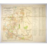
[CHORZÓW]. Königshütte, Oberschlesien. Color plan 48.5x42 on ark. 53x62 cm. Plan prepared by the Städt. Vermessungsamt in Chorzow in 1941. printed in Berliner Lithograph. Inst. Title in box in upper left corner, scale there (1:15,000), linear scale and short legend. In the right margin a list of streets and more important buildings. Verso clean. Folds and edge tears, rubbing at folds.
[CALVARY Zebrzydowska]. Mons Calvariae. Copperplate colored engraving form. 32.4x45 cm. View of the sanctuary in Kalwaria Zebrzydowska with the Stations of the Cross taken from Georg Braun and Franz Hogenberg's work "Civitates orbis terrarum", vol. 6, Cologne 1618. Title under the upper frame, slightly to the right. Below, cartouche with dedication to Nicolaus Zebrzydowski, surmounted by figur...
MAP OF THE TEN GUBERNIAS OF THE KINGDOM OF POLAND by P.A. Barcz with indication of iron, beaten and ordinary roads Warsaw 1901 Good condition: map glued on canvas. Format: 80x60 cm
KŁODAWA. Lane 39. pole 28. w-wa 1930. published by WIG. Scale 1 : 100,000. format 47/35 cm. Colored. German printed publisher's inscription : Grasblatt 69a SO. Sonderausgabe! Nur für den Dienstgebrauch! Stamp : For official use only.
SAMBOR. Lane 50; Pole 36; W-wa 1937. published by WIG. Scale 1 : 100,000. format 47/37 cm. Black and white. Folding marks, punch mark on one of the margins, some underlining in red crayon. German publisher's printed inscriptions : Grasblat 414 NO. Sonderausgabe! Nur für den Dienstgebraucg!
[POLAND]. Mappa of the Kingdom of Poland with distance markings on iron, beaten and ordinary roads laid out and lithographed by Marceli Gotz. Colored lithograph form. 70x57 cm. Szaniawska II 118. Overview map of the Kingdom of Poland arranged and lithographed by Marceli Gotz, published in Warsaw by Gebethner & Wolff in 1881. Title in a frame in the upper left corner, below it a legend in a...
[TATRY]. Tatra Mountains. View from the north. Color panoramic map form. 26.8x78 cm. Panorama drawn by Tadeusz Zwolinski, published in Zakopane in 1936 by the Tourism Promotion League, printed in the National Printing House in Cracow. Covers the area from Spisz to Studena Woda Valley, in the foreground a view of Zakopane. On the back informative text, photographs, schematic map. Traces of fold...
[VILNA]. Plan of the city of Vilnius. Color plan form. 56.6x46.8 cm. First edition of the plan elaborated. by St. Januszewicz, published in Vilnius in 1921 by Księg. J. Zawadzki and attached to the index of 1922. Printed in Bydgoszcz in Zakł. Graf. "Bibliot. Pol." Plan with index. Title in frame in upper left corner, scale (1:12,500) and linear scales there. Plan divided into sectors (1-10, ...
Tourist map of the Polish Carpathians. 1:100000 Krynia - Nowy Sacz Warsaw 1928 Good condition. Format: 46x41 cm
RYPIN. Lane 36. pole 29. w-wa 1930. published by WIG. Scale 1 : 100,000. format 47/37 cm. Color. Creases and minor tears in margins. German printed publisher's inscription : Grosblat 339 NW. Sonderausgabe! Nur für den Dienstgebrauch!
[LVIV]. Lviv plan. Color plan form. 40.8x34.7 on ark. 66.5x96.3 cm. City plan issued before WWI, without publishing data. The plan is divided into sectors (I-VIII, A-E). Much of the sheet is taken up by numerous advertisements of Lviv companies. On the back a map of the Lviv area and information about museums, churches, public buildings in Polish, German and French. Preserved brochure covers. ...
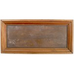
A very nice copperplate reproduction of Dahlberg's work. The product of the 20th century. Preservation condition of the object very good -. Wood, copper, dimensions 37x13,5 with frame 20,5 x 42,6 cm.
[POLAND]. Le Royaume de Pologne, divisé selon les Partages faits en 1772, 1793 et 1795, entre la Russie, la Prusse et l'Autriche. Colorized copperplate form. 47.7x53.6 cm. Imago Pol. K47/4. Map of Poland (third state) by Gilles and Didier Robert de Vaugonda with the borders of the three partitions marked, published in Paris after 1795 by Hyacinthe Langlois. Title in upper left corner, in a ca...
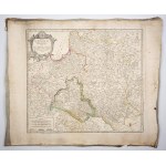
[BESKIDS]. Touren-Karte für die Beskiden von der Babiagóra bis zum Smrk von Schorr, Kuhn und Schlesinger. The fourth completed edition of Karl Hussak's tourist map of the Beskids, published in Cieszyn in 1911 by the Beskidenverein there. The map was rebound in the lithographic works of Karl Prochaska. Title in box under upper left frame, publishing data and scale (1:150,000) there. In the up...
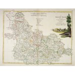
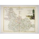
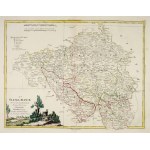
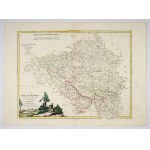
[SILESIA]. La Slesia Infer-e divisa ne suoi proncipati. Di nuova Projezione. Copperplate colored engraving form. 32.8x42.8 cm. Map of Upper Silesia taken from "Atlante novissimo illustrato" (Venice 1779-1782, published by Antonio Zatta). Title in upper right corner, date 1779 there. Under the upper frame in the center two linear scales and legend. Above the upper frame on the right No. VIII. U...
[SILESIA]. La Slesia Super-e divisa ne suoi proncipati. Di nuova Projezione. Copperplate colored engraving form. 31.3x40.6 cm. Map of Upper Silesia taken from "Atlante novissimo illustrato" (Venice 1779-1782, published by Antonio Zatta). Title in the lower left corner, date 1779 there. Under the upper frame on the left two linear scales and a legend. Above the upper frame on the right, number ...
[EXCLUSIVE]. Karte des Gebietes der Freien Stadt Danzig (1 cm-Karte). Map form. 68.8x87.7 on ark. 79.4x98.3 cm. Map of the distant environs of Danzig, prepared in Berlin by the Reichsamt für Landesaufname and published there in 1930. Title on the background of the Baltic Sea. In the right margin an elaborate legend. In the lower margin publishing data, linear scale and scale (1:100,000). Cove...
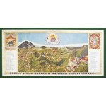
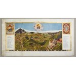
[KALWARIA Zebrzydowska]. General view of the paths in Kalwaria Zebrzydowska. Color print form. 19.5x44.5 on ark. 24.7x48.5 cm. Panorama of the Kalwaria sanctuary, probably published in the 1930s by Jozef Cebulski in Cracow. Title on the lower frame, in the upper corners a figure depicting the Third Fall of Christ and the frame of the Virgin Mary from the main altar. On both sides of the panora...
STOLECKI Kazimierz Plan of Greater Cracow. Lithograph Pruszyński Cover of the VI. Congress of Polish Technicians Cracow 1912 Good condition. Format: 69x94 cm
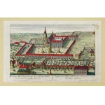
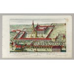
[HENRICHS]. Prospectus Henrichovy Coenoby Sacr. ac Exemt. Ordinis Cisterciensis, in Silesia superiore. Prospect des Stüffts Heinrichau, Cistercienser-ordinis in Ober-Schlesien. Colored copperplate form. 16.8x28.6 cm. Cistercian monastery in Henryków from a bird's eye view on a copperplate engraving by Johann Georg Merz based on a drawing by Friedrich Bernard Werner, published in Augsburg aro...
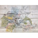
Map of Lodz. Plan von Litzmannstadt mit strassenverzeichnis. 1940s. Occupation. Good condition. Format: 75x95 cm
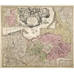
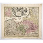
[PRUSY]. Borussiae Regnum sub fortissimo Tutamine et juristissimo Regimine [...] Friderici Wilhelmi [...] cum adjacentib. Regionibus mappa Geographica delineatum. Copperplate colored engraving form. 48.8x56.7 cm. Krassowski 131. first edition of the map of Prussia by Matthäus Georg Seutter published in Augsburg in 1725-1728. It was published as a self-contained map, and was also included in a...
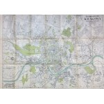
Get to know Krakow. Detailed plan of the city of Cracow with adjacent municipalities. 1947 condition. Good condition. Format:

![[TATRY]. The High Tatras according to photographs of 1896/97. color lithograph form. 74,3x111,...](https://img1.one.bid/img/8698/2897288_1w.jpg)
![[SILESIA]. Superioris et Inferioris Ducatus Silesiae. Before 1729.](https://img1.one.bid/img/8698/2897285_1w.jpg)
![[SILESIA]. Superioris et Inferioris Ducatus Silesiae. Before 1729.](https://img1.one.bid/img/8698/2897285_2w.jpg)
![[ZAKOPANE]. Zakopane. Color plan from 1940](https://img1.one.bid/img/8698/2897310_1w.jpg)
![[CALVARY Zebrzydowska]. Mons Calvariae. Copperplate colored engraving from 1618](https://img1.one.bid/img/8698/2897294_1w.jpg)
![[CALVARY Zebrzydowska]. Mons Calvariae. Copperplate colored engraving from 1618](https://img1.one.bid/img/8698/2897294_2w.jpg)
![Barcz P. - Map of ten gubernias of the Kingdom of Poland - Warsaw 1901 [iron roads, beaten and ordinary].](https://img1.one.bid/img/8954/2898511_1w.jpg)
![Barcz P. - Map of ten gubernias of the Kingdom of Poland - Warsaw 1901 [iron roads, beaten and ordinary].](https://img1.one.bid/img/8954/2898511_2w.jpg)

![[TATRY]. Tatra Mountains. View from the north. Panorama from 1936](https://img1.one.bid/img/8698/2897305_1w.jpg)
![[LVIV]. Lviv plan. Color plan from before the First War](https://img1.one.bid/img/8698/2897303_1w.jpg)
![[LVIV]. Lviv plan. Color plan from before the First War](https://img1.one.bid/img/8698/2897303_2w.jpg)
![[BESKIDS]. Touren-Karte für die Beskiden von der Babiagóra bis zum Smrk von Schorr,...](https://img1.one.bid/img/8698/2897283_1w.jpg)
![[EXCLUSIVE]. Karte des Gebietes der Freien Stadt Danzig . 1930.](https://img1.one.bid/img/8698/2897289_1w.jpg)

![Map of Lodz. Plan von Litzmannstadt mit strassenverzeichnis - ca 1940 [occupation].](https://img1.one.bid/img/8954/2898528_1w.jpg)
![Map of Lodz. Plan von Litzmannstadt mit strassenverzeichnis - ca 1940 [occupation].](https://img1.one.bid/img/8954/2898528_2w.jpg)
